
When you look across South Africa’s landscapes, from the skyline of Cape Town to the misty ridges of KwaZulu-Natal, you begin to realise how deeply the land is shaped by its height and form.
More than just postcard material, the mountains in South Africa influence rainfall, biodiversity, rivers, and even where towns and farms are developed. Whether you have walked up Lion’s Head on a school hike or driven through the sweeping curves near Clarens, you have experienced how the mountains of South Africa shape daily life.


Why Mountains Matter in Everyday Life
From the iconic Table Mountain to the towering Drakensberg, the country’s mountainous areas form natural barriers and gateways. All of these formations belong to a network of mountain ranges in South Africa that stretch across provinces and ecosystems, and they also include the vast Great Escarpment, a dramatic geological feature that separates the high interior plateau from the coastal plains.
Understanding the highest mountains in South Africa can give you insight into how geography connects climate, rivers, and biodiversity. It also helps explain why the mountain passes of South Africa were historically vital routes linking inland settlements to coastal ports.
You might not think about it when driving to school in Johannesburg or hiking near Stellenbosch, but the mountains in South Africa influence:
Weather
Agriculture
Water supply
High elevations capture rainfall that feeds rivers and dams, and without the mountains of South Africa, rivers would not flow as they do.
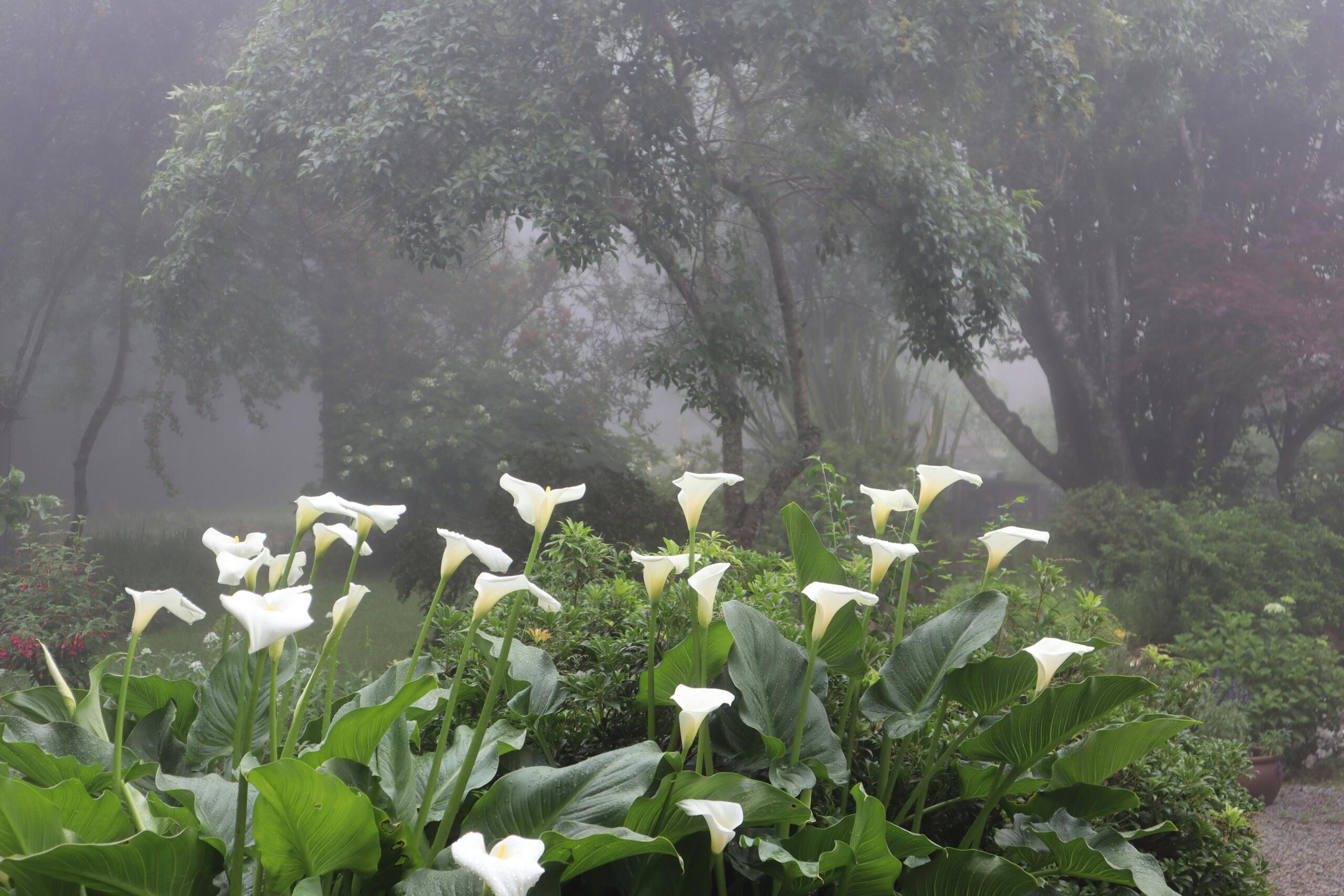
Altitude also shapes ecosystems. In the Drakensberg for instance, alpine grasslands thrive where temperatures drop sharply with height. In the Cape Fold Belt, Fynbos vegetation adapts to rocky slopes and nutrient-poor soils. These contrasts can help learners connect geography with biology and environmental science.
If you have read our article on South Africa's climate and weather patterns, you will know how altitude affects rainfall and temperature. In essence, the presence of mountain ranges in South Africa explains why some regions are wetter than others and why frost forms on the Highveld in winter.
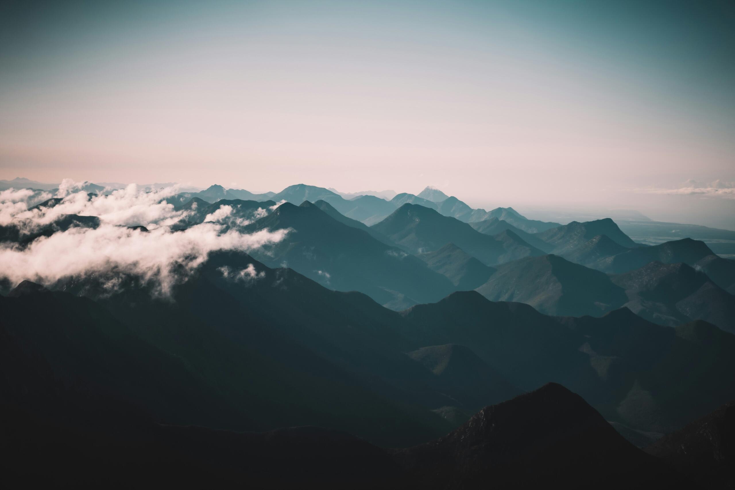
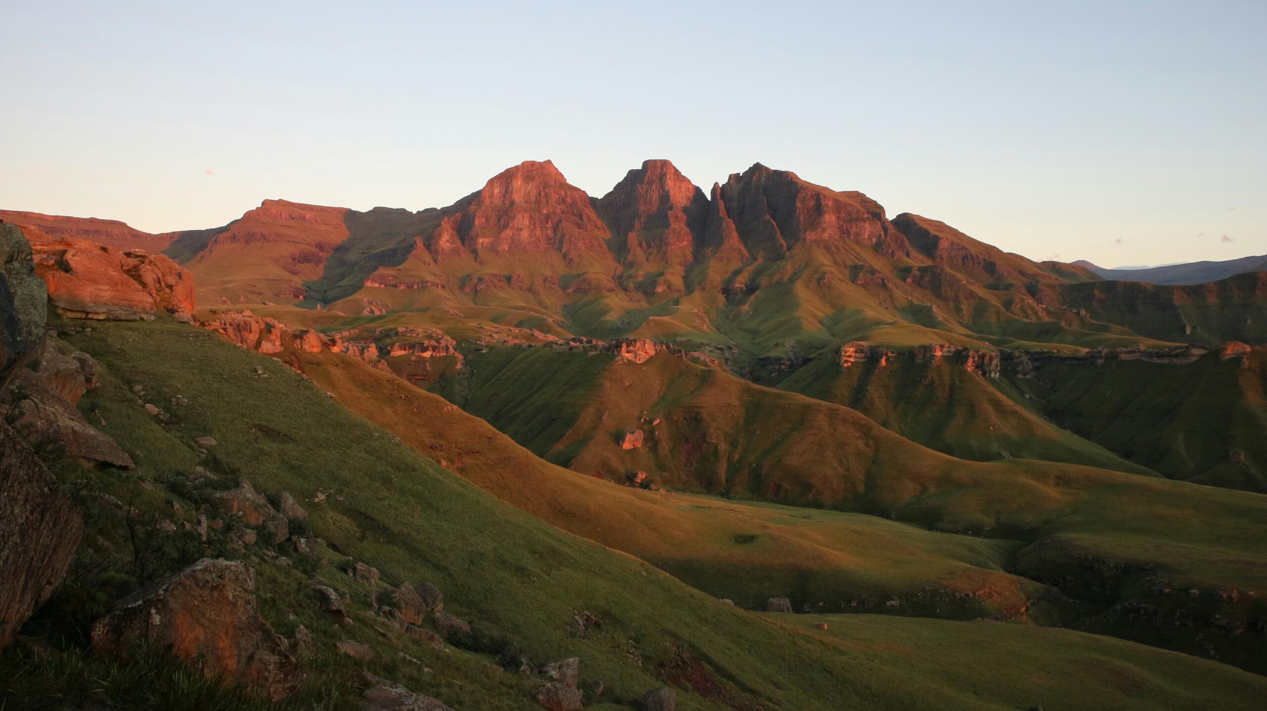
The Drakensberg: Home to the Highest Peaks
The Drakensberg, meaning “Dragon Mountains”, contains some of the highest mountains in South Africa.
Mafadi Peak, Drakensberg and Lesotho Border
One of the most striking features is the Amphitheatre, a sheer rock wall that stretches for kilometres. Here you will find Tugela Falls, one of the tallest waterfalls in the world. School geography trips often include visits to Royal Natal National Park, where learners can see how erosion shaped these cliffs over millions of years.
The Drakensberg, which forms part of the broader mountain ranges in South Africa, plays a key role in water supply. Here, rainfall captured feeds rivers that sustain agriculture and urban centres and without these mountains of South Africa, much of the interior would be far drier.
Table Mountain and the Cape Fold Belt
In the Western Cape, the landscape tells a different geological story. The mountains in South Africa found here belong to the Cape Fold Belt, formed through ancient tectonic forces that folded layers of rock.
million years ago during the late Palaeozoic era
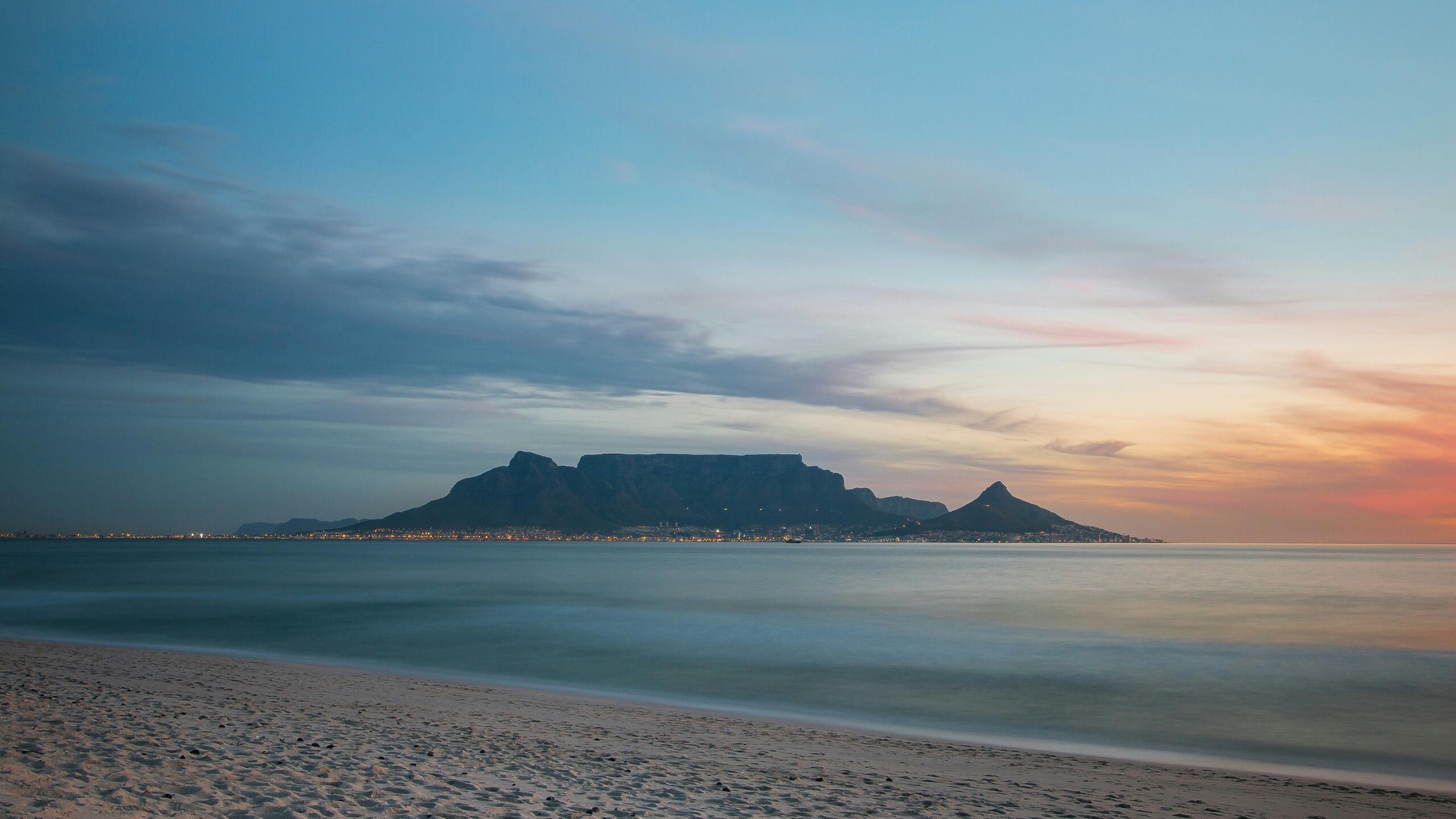
Besides Table Mountain National Park, nearby ranges such as the Hottentots Holland Mountains and the Cederberg add to the diversity of mountain ranges in South Africa. For learners in Cape Town schools, field trips to these areas provide practical lessons in geology. Rock formations show how sedimentary layers were compressed and uplifted. The slopes also support fynbos ecosystems, linking geography with environmental studies.
Explore our article on South Africa's unique geographical features to find out how the Cape Fold Belt fits into the country’s broader landscape story.
The Great Escarpment: A Natural Divider
Running across much of the country, the Great Escarpment forms a dramatic boundary between the high plateau and coastal plains. This escarpment is one of the defining mountain ranges in South Africa.
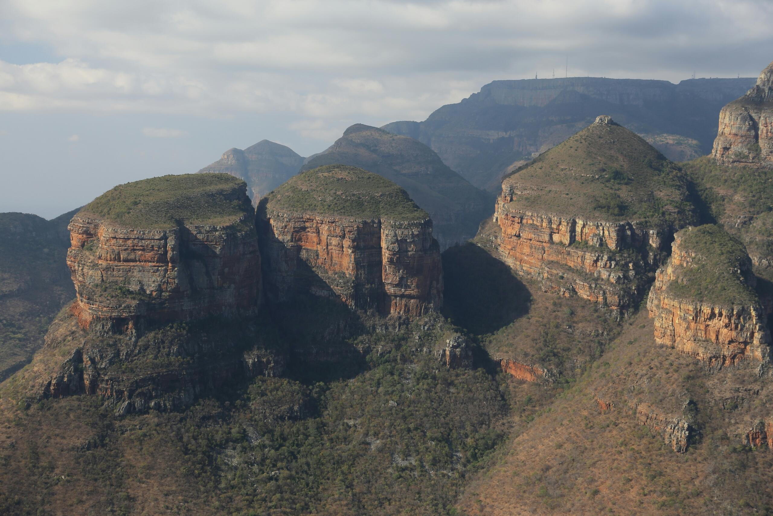
In Mpumalanga, you can visit the Panorama Route, where viewpoints like God’s Window reveal how the land drops sharply toward the Lowveld. Here, the mountains of South Africa shape both scenery and climate.
The escarpment also influences rainfall patterns. Moist air from the Indian Ocean rises along these slopes, producing orographic rain that feeds rivers and supports agriculture. This connection becomes clearer when you learn more about deltas and grasslands, where water systems depend on these upland sources.
Mountain Passes and Human History
Travel across South Africa has long depended on the mountain passes of South Africa and before modern highways, these routes were lifelines connecting inland settlements to coastal ports.
kilometres
Passes such as those in the Drakensberg or the Western Cape allowed trade, migration, and cultural exchange. Even today, scenic routes like those near Swellendam or in the Eastern Cape highlight how the mountain passes of South Africa combine engineering with natural geography.
Driving through these passes gives you a sense of how challenging travel once was. For learners, studying the mountain passes of South Africa offers insight into history, infrastructure, and environmental adaptation.
How Mountains Shape Everyday Life
Mountains are not just distant landmarks on the horizon. Across South Africa, they shape how people live, travel, learn, and connect with nature. From rural towns to busy tourism hubs, mountain landscapes influence daily life in ways that are practical, educational, and deeply tied to the environment.
Mountains quietly influence many parts of life in South Africa:
Together, these factors show how mountain landscapes influence both environment and economy. They support livelihoods, inspire learning, and help sustain natural systems.
Whether you are travelling through a scenic route, planning a school outing, or simply observing your surroundings, these landscapes play an ongoing role in shaping everyday South African life.
Learning from Mountains
Mountains are excellent teaching tools. When you visit the highest mountains in South Africa, you can observe how temperature drops with altitude. Vegetation changes as you climb, showing how ecosystems adapt.
Parents and tutors can encourage simple field observations:
These experiences connect with South Africa: Climate and Weather Patterns, where altitude influences rainfall and temperature.
Safety and Practical Tips
If you plan to explore the mountains in South Africa, safety matters. Weather can change quickly at higher elevations. Proper footwear, water, and awareness of trail conditions are essential.
School trips often include guided hikes in areas such as the Drakensberg or Cape Fold Belt. These outings allow learners to experience the mountains of South Africa firsthand while understanding environmental conservation.
You’ll Move Mountains …
Whether you are a learner, parent, or simply curious about the land, understanding the mountains of South Africa deepens your appreciation of the country’s geography and its connections to rivers, grasslands, and climate.
From the towering peaks of the Drakensberg to the sculpted slopes of Table Mountain, the mountains in South Africa shape the country’s ecosystems, landscapes and climate. The diversity of mountain ranges in South Africa reveals how geology and time have shaped the land.
Exploring the highest mountains in South Africa helps you understand how altitude influences rainfall, rivers, and biodiversity. Meanwhile, the mountain passes of South Africa remind us of the human stories linked to these natural features.
Summarise with AI:
Enjoyed this article? Leave a rating!